
Shan North Property
Overview
Shan Molybdenum Discovery
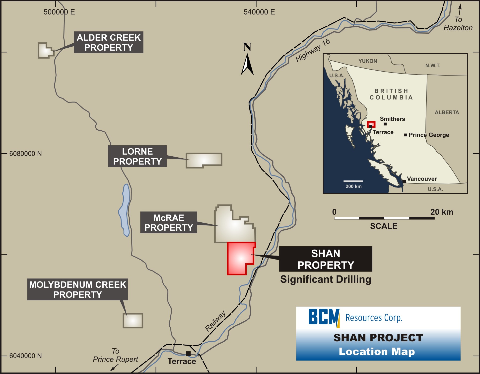
The Shan group of claims enjoy excellent access to infrastructure. A transcontinental railroad running on the Shan side of the Skeena River leads directly to the deep water ports of Kitimat (80 km south) and Prince Rupert (163 km west). On the opposite side of the river, linked by a bridge that serves a network of logging roads into the Company's claims, is a main arterial highway (Highway 16). High powered transmission lines are within 4 km, and the community of Terrace lies 20 km to the south.
Since acquiring the original group of claims, BCM Resources Corp. has conducted extensive exploration work resulting in two molybdenum discoveries at Shan South and Shan North.
18, 791 Acres
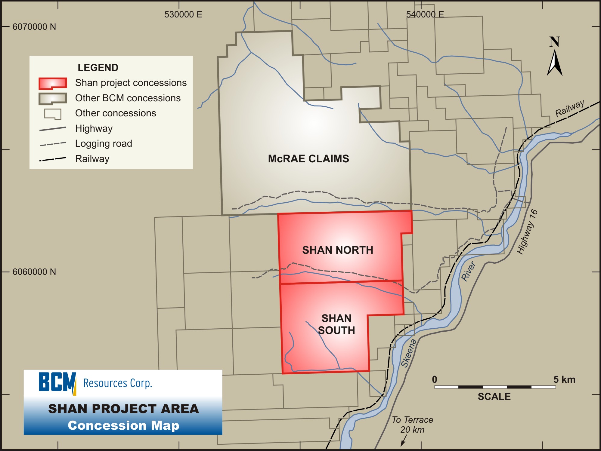
The Shan North claim block was added to the Company's portfolio in fall, 2006 and comprises 3,645 acres. The Shan North claims lie immediately adjacent and to the north of the Company's original Shan South claims.
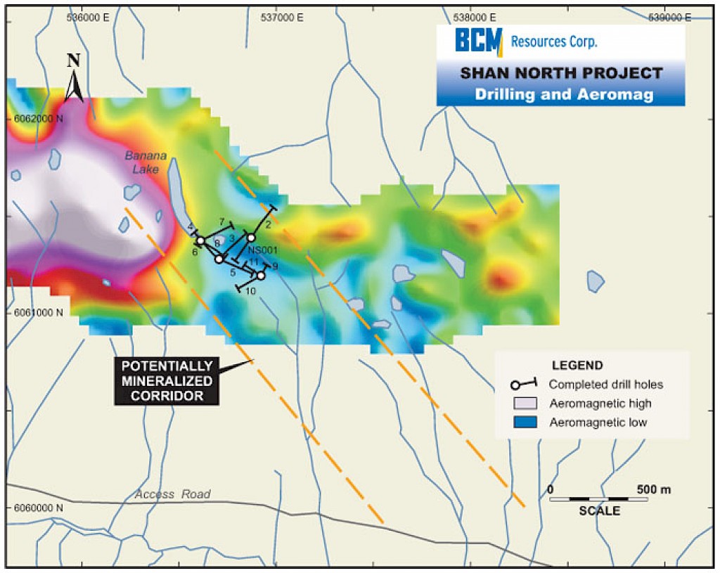
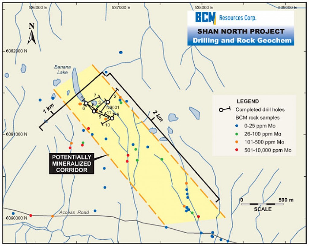
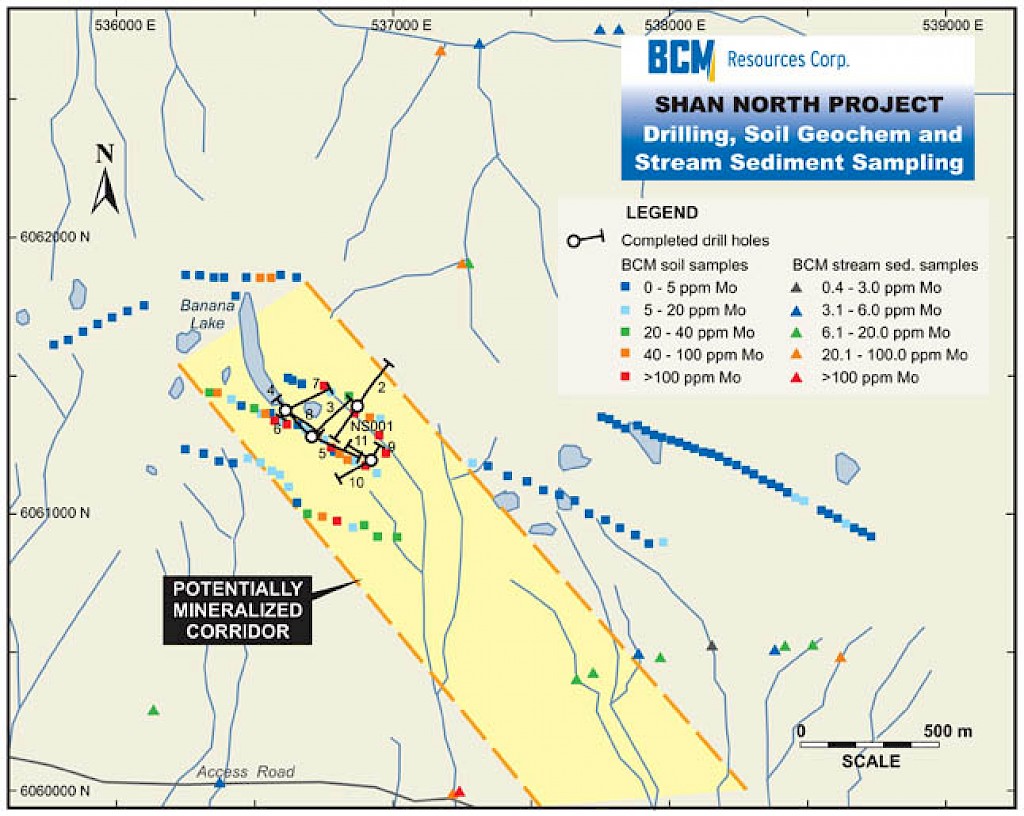
Since its aquisition of these claims the Company has completed several exploration programs. Extensive field work, mapping and sampling have been conducted at Shan North, resulting in the delineation of a large zone of highly anomoulous molybdenum referred to as the Banana Lake Corridor, located approximately 3 km north of the Las Margaritas discovery at Shan South. The entire Shan North property was covered by a broad aeromag survey flown in the summer of 2007 over the region. A Phase 1 diamond-drill program was completed in the Banana Lake Corridor comprising 11 holes and 2,470 meters.
2007 Exploration & Drill Program
In the Summer of 2007, Shan North property was included in a broad aeromagnetic survey cnducted over the region. At Shan North, the survey detected a number of areas of low magnetic intensity which could represent areas of magnetite destruction, which is often associated with Mo mineralization.
Immediately following, a reconnaissance sampling program was completed in the Banana Lake area of Shan North which included extensive field work, mapping and geochemical sampling. Widespread molybdenum (Mo) mineralization was encountered. Results from grid-based soil sampling carried out during the summer of 2007 returned numerous strongly anomalous Mo values (up to a maximum of 324 ppm). Results from bedrock samples of scattered quartz molybdenum vein outcrops and sub-crops ranged up to 0.2% Mo, the upper detection limit. The Company's field work confirms historical reports that identified a significant molybdenum soil geochemical anomaly over an area of 2 x 1 kilometers, now referred to as the Banana Lake Area.
 The Company completed a Phase 1 diamond-drill program in the Banana Lake region of Shan North in December 2007. 11 holes totalling 2,470 meters were drilled. This program was designed to test a 600 x 400 meter zone where both geophysical and geochemical anomalies coincide.
Highlights of the Phase 1 drill program include .08% molybdenum (Mo) over 22 meters including .15% Mo over 9.5 meters (Hole NS 004) and 0.10% Mo over 14 meters (NS 010). With the exception of NS002 & NS006, all holes returned molybdenum mineralization.
The drill program revealed widespread stockwork mineralization with local high-grade occurrences. For example, NS 004 returned 0.40% Mo over 2.5 m and NS 001 returned 0.33 %.
The mineralized zone is open at depth, to the north and to the south-west
2008 Exploration Program
Additional reconnaissance work was completed in summer 2008 to better define follow-up drill targets before commencing a Phase 2 drill program, and to investigate other areas of interest at Shan North that have been identified through detailed study of 3-D magnetic models (created from the aero-mag survey) prepared by the Company's geophysical consultant. This work included soil and moss mat samples.
Soil lines on the north side of Banana Lake confirmed that the NW trending mineralized corridor extends to the north, with anomalous soils indicating a zone about 75 m wide.
Increased zinc, copper and molybdenum assays in the easternmost moss matt sample, corresponding to an area of decreased magnetic susceptibility, indicates potential for mineralization to the east of the 2008 field work. This will be investigated in summer of 2009.